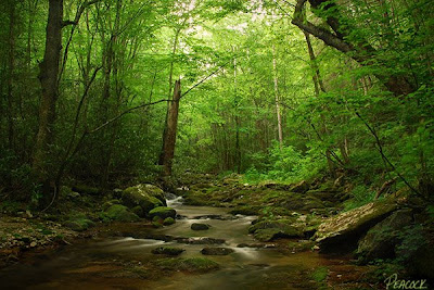
One of the most popular waterfalls to visit in Greene County, TN is the spectacular, 60-foot-tall Margarette Falls (sometimes spelled 'Marguerite'). The hike to get there is surprisingly beautiful, but also fairly strenuous. The trail snakes its way through impressive rock formations, over and around lots of small waterfalls and cascades, and across four creek crossings as it makes its way through the gorge to the falls. Even though it's listed as a moderate/strenuous hike (the slick rocks, the humidity and my backpack weren't helping me), I have to say it's one of the most scenic hikes in our area. The waterfall itself is magnificent - the combination of free-falling water and cascades makes this waterfall unique and picturesque.
Directions from I-26 -- take the Erwin/Jonesborough exit #37. At the end of the ramp, turn west toward Jonesborough taking State Route 81/107 west for 6.5 miles; stay on Rt. 107 by turning left and continuing for 16 more miles until you reach Route 351, turn left and travel for 4.5 miles, then take another left onto Route 350 (Greystone Road). Continue on for 3.8 miles and then turn right onto Shelton Mission Road. After 1.3 miles, turn right into the large gravel parking area for Margarette Falls, Phillips Hollow Trail and Bullen Hollow Trail (watch your odometer, the parking lot is easy to pass because the sign for it faces the other direction!).
After parking, walk the gravel road for 1/2 mile to another clearing. From here, take the trail to your right and almost immediately you'll come to another fork, go left. Follow the trail for approximately 0.7 more miles to the falls (it seems much farther!). Both Bill Fuller and Wendell Dingus describe two more waterfalls above Margarette, click here and here for more.
Update 8/31/08: Click here to read the account of a young hiker who was seriously injured when he slipped and fell 40' while attempting to climb Margarette -- in all, it took a team of 80 volunteers to rescue him.
Update 4/17/12: They've rerouted the trail and built a bridge, which changed this hike significantly. It's still a lovely hike, but to be honest, it's not quite the same. While the trail still follows the creek, it has been moved up the sides of the surrounding hills for much of the hike. The good news is that there is now only one creek crossing. Also, evidence of the terrible storms that blew through this area two years ago can still be seen with all the trees that were blown down. Still recommend the hike - the falls are gorgeous!
Monday, June 30, 2008
Sunday, June 29, 2008
Showing Gratitude
Enjoy life, it's ungrateful not to.
--Ronald Reagan (1911-2004) 40th US President
Above: Duke leading the way on the Appalachian Trail over Iron Mountain.
--Ronald Reagan (1911-2004) 40th US President
Above: Duke leading the way on the Appalachian Trail over Iron Mountain.
Saturday, June 28, 2008
Young Summer
What is one to say about June, the time of perfect young summer, the fulfillment of the promise of the earlier months, and with as yet no sign to remind one that its fresh young beauty will ever fade.
--Gertrude Jekyll (1843-1932) British garden designer, writer, and artist
Above: Glowing leaves along the Appalachian Trail in Unicoi County, TN
--Gertrude Jekyll (1843-1932) British garden designer, writer, and artist
Above: Glowing leaves along the Appalachian Trail in Unicoi County, TN
Friday, June 27, 2008
Looking deep
Thursday, June 26, 2008
Roan High Bluff Overlook
This one just makes me laugh. Milligan College photography major Michael Kaal (click here to see his gallery) and Duke check out the view from the Roan High Bluff Overlook. The view is amazing -- and the short hike to get there is just as thrilling. I love the smell of the pines on Roan - the rush of the wind - the green moss, the bent trees and the rugged boulders. I have lots of fond memories associated with this trail. It's one of those destinations I've been taking family and friends to see ever since I moved here in 1995. There are many days when you look out over the rail and see misty clouds forming in the valley being swooped up the mountain side -- and you watch as they rush over you and the mountain. The next time you visit Roan, here are some things you won't want to miss...
Carver's Gap, the Appalachian Trail and the Balds - the trail up to Round Bald is unforgettable, as are the views once you reach the top
The Old Cloudland Hotel Site - lots of wildflowers
Sunset Rock - secluded overlook, great view!
Roan High Knob Shelter - the highest shelter on the AT
The Rhododendron Gardens - pretty any time of year, but especially in June.
Roan High Bluff Overlook (this post) - a short and interesting hike with a fantastic view
Directions: Take Route 19E to the town of Roan Mountain, turn onto Route 143 and travel 12.8 miles to the TN/NC state line (Carver's Gap). On your way up the mountain, you'll pass by the Dave Miller Homestead and the Roan Mountain State Park. Eventually, you leave the state park and enter the national forest. At Carver's Gap turn right, following the signs to the Cloudland Hotel site and Rhododendron Gardens two miles up! After checking out the Cloudland site, Sunset Rock and the Rhododendron Gardens, drive on to the end of the gravel parking area and park at the trail head for the Roan High Bluff -- a short hike (1/2 mile) will take you to the overlook. After that, return to Carver's Gap on your way down from the gardens and take the Appalachian Trail to the top of Round Bald -- this short hike will give you an amazing panoramic views of the mountains, a short distance further on the AT will take you to Jane Bald. If you continue on, you'll reach Grassy Bald. Click here for information about hiking the AT through the Roan Highlands; click here for a topo map of Roan Mountain.
Tuesday, June 24, 2008
Turn, turn, turn
If you look closely, you'll occasionally find small whirlpools formed by the turning currents of creeks and waterfalls. To get the effect you see above, I simply threw in some green and brown leaves and left the shutter open for five seconds. I love when these shots work -- because then the 'hidden' water currents reveal an entirely different dimension of the waterfall. Of course for this shot to work, you have to use a tripod and have a cloudy day with no harsh sunlight. Click here to see a previous 'leaf swirl' photo. This small waterfall is located above the main 60' Red Fork Falls in Unicoi County, TN. With eight different waterfalls, it's a great place to explore! But as always when I write about Red Fork, I have to note that this is one of the most dangerous destinations in our area, the easy accessibility of the falls often lures visitors into places they should not go. So if you visit, be careful! (Click here, here and here for more information). Click here for my previous posts for directions, photos and descriptions of the hike.
Click here for a post listing all there is to see and do on Unaka Mountain.
Monday, June 23, 2008
Mountain Laurels on Stamping Ground Ridge
Okay, so it may not be nearly as amazing as the rhododendron garden on Roan Mountain, but the Mountain Laurel blooms on Unaka mountain are still worth the trip. This heath bald is another of the little known gems of Unicoi County, TN (a heath bald means you'll find mostly rhododendron, mountain laurel, blueberry bushes and other shrubs -- with very few or no trees). Stamping Ground is beautiful with its unique plants and wonderful views. The trail itself goes all the way down to the old Limestone Cove camp 3.9 miles below, but it's insanely steep (click here for more info). I'd recommend you drive up to Stamping Ground via the Unaka Mountain Road, and walk the top portion of the ridge (a short and easy stroll -- approximately 1/2 mile) to where the trail enters the forest.
Directions: From I-26 take the Unicoi exit (#32). At the end of exit ramp turn east towards town. At the stop sign, turn right onto Unicoi Road (which is also known locally as the Erwin Highway) and proceed for 0.7 miles. Follow the signs pointing to the Cherokee National Forest by turning left onto Rt. 107 (Limestone Cove Road). Drive 7.8 miles, turn right on Red Fork Road (it's also referred to as Unaka Mountain Road). Proceed up the mountain for 6 miles to a well-marked parking area and trail head to your right. Note: They've really worked on this section of the Unaka Mountain Road, it's in the best shape I've ever seen. In the past I've always recommended high clearance vehicles (truck, jeep, van or SUV), but now I'd say most cars should make it up this particular section of the gravel road with little or no problem. If you're planning a trip to Stamping Ground Ridge, you should also check out Red Fork Falls and Horseback Ridge.
Click here for a post listing all there is to see and do on Unaka Mountain.
Sunday, June 22, 2008
Gray's Lily
The Gray's Lily is a rare and endangered flower found only in this part of Appalachia (TN, NC and VA). The flowers pictured here were all found on Jane Bald, one of three balds in the Roan Highlands. Round Bald, Jane Bald and Grassy Bald -- all three offer breathtaking panoramic views. I've heard locals refer to them as the 'three sisters'. These grassy, treeless mountaintops, are unique and very fragile ecosystems. Here you will find plant species unique to Appalachia, like the Gray's Lily. It is named for Asa Gray, the father of American botany, who discovered the flower in 1841. See yesterday's post for directions to Roan Mountain.
Each moment of the year has its own beauty . . . a picture which was never before and shall never be seen again.
--Ralph Waldo Emerson (1803-1882) philosopher and writer
Each moment of the year has its own beauty . . . a picture which was never before and shall never be seen again.
--Ralph Waldo Emerson (1803-1882) philosopher and writer
Saturday, June 21, 2008
"A Jewel of Nature"
The 62nd annual Roan Mountain Rhododendron Festival is underway! As you can see the festival planners picked the perfect weekend for the celebration -- the rhodos on top of Roan Mountain are at their peak this weekend. If you hike the balds from Carver's Gap, you'll also find that the flame azalea are also in bloom (although they're a little past their peak). The Gray's Lilies are blooming on Jane Bald, and will probably reach their peak this coming week. The festival activities take place down at the state park -- click here for the schedule of events. Click here for more information on Roan Mountain.
Directions: Take Route 19E to the town of Roan Mountain, turn onto Route 143 and travel 12.8 miles to the TN/NC state line (Carver's Gap). On your way up the mountain, you'll pass through the Roan Mountain State Park. Eventually, you leave the state park and enter the national forest. At Carver's Gap turn right, following the signs to the Rhododendron Gardens two miles up!
Other things to do: Click here for a list of all the things to see and do on Roan Mountain.
Thursday, June 19, 2008
an easy choice
I had rather be on my farm than be emperor of the world.
--George Washington (1732-1799)
The photo above is similar to yesterday's photograph in that I moved the horizon down in both images to show off the beautiful blue skies. The evening light was amazing -- and the blues and reds and yellows really popped. It was one of those times you knew the light was just right. To be on such a wonderful farm walking around the old barns and following the meandering cow paths through the rolling fields makes for an easy choice.
Wednesday, June 18, 2008
Be who you is...
To be what we are, and to become what we are capable of becoming is the only end of life.
--Robert Louis Stevenson (1850-1894) Scottish author
This quote reminds me of advice author Brennan Manning gave in his classic "The Ragamuffin Gospel"...
One of the wonderful results of my consciousness of God's staggering love for me as I am is a freedom not to be who I should be or who others want me to be. I can be who I really am.
When I get honest, I admit I am is a bundle of paradoxes. I believe and doubt, I hope and get discouraged, I love and I hate, I feel bad about feeling good, I feel guilty about not feeling guilty. I am trusting and suspicious. I am honest and I still play games. Aristotle said I am a rational animal; I say I am an angel with an incredible capacity for beer.
It is the real me that God loves. I don't have to be anyone else. For 20 years I tried to be brother Teresa. I tried to be Francis of Assisi. I had to be a carbon copy of a great saint rather than the original God intended me to be. My 70-year-old spiritual director, Larry Hine, gave me a word from the Lord that he heard once from a black, evangelical preacher in Georgia. "Be who you is, because if you ain't who you is, you is who you ain't."
--Brennan Manning
Above: A tree near Aunt Willie's Wildflowers, Sullivan County, TN
Monday, June 16, 2008
A Walk in the Woods
Sunday, June 15, 2008
Erwin Presbyterian Church
The Erwin Presbyterian Church is one of the more distinctive churches in our area. This magnificent structure was completed in 1926 and is located on Elm Street just a block from downtown Erwin, TN. Click the link above for the church schedule and map.
We cannot have a clear and complete knowledge of God unless it is accompanied by a corresponding knowledge of ourselves.
--John Calvin (1509-1564) Protestant Reformer
We cannot have a clear and complete knowledge of God unless it is accompanied by a corresponding knowledge of ourselves.
--John Calvin (1509-1564) Protestant Reformer
Friday, June 13, 2008
Thursday, June 12, 2008
Serene Majesty
Seconds after I took this shot of Rocky Fork's serene and settled woodland, some yahoo on a four-wheeler came screaming around the corner, barely slowing down as he passed by. It was late, around 8:30 p.m. - and I'm sure he wondered what I was doing standing in the middle of the road in the middle of nowhere taking pictures -- just as much as I wondered why he was so strangely out of place. I'm not sure why people can't just enjoy the serenity of the woods and leave them unredneckified. The beauty of Rocky Fork is not just in what the eyes can see, it's also experienced in our other senses. But we've really got to get out and walk around -- slow down and take the time to watch the light filter through the trees, hear the creek rush against the rocks, feel and smell the breeze as it gently rustles the rhododendron and the pines. A visit to the woods ought to do something to the soul and elevate our thoughts, and bring us to the doorstep of worship and more purposeful living. If it doesn't do this it simply means we aren't paying close enough attention.
Directions: Take the Flag Pond exit off of I-26 (exit #50), at the stop sign turn left onto Higgins Creek Road. Drive ½ mile, til you reach Rt. 23, turn right and travel 2 ¼ mi. thru Flag Pond, then turn left on Rocky Fork Road. Take your time driving up this road, the creek offers amazing cascades and waterfalls. After ¾ mi. you will see a gravel pull-off to the left. Park here (out of the way of the gate) and follow the gravel lane into Rocky Fork on foot. Click here for a trail map.
Tuesday, June 10, 2008
what a wonderful world
We live in a wonderful world that is full of beauty, charm and adventure. There is no end to the adventures that we can have if only we seek them with our eyes open.
--Jawaharlal Nehru (1889-1964) Indian Prime Minister
The Unicoi County Mountain Expo is coming up June 20-22 -- featuring guided hikes and other outdoor adventures, speakers on practically every possible outdoor recreation topic you can imagine, shopping and entertainment. It is a very ambitious schedule with something for everyone. Click the link above and you'll see what I mean. I'm so happy that Unicoi County, my home for the past seven years, has put this event together to encourage folks to get out and explore its treasures. If you can't wait till the Expo to get started on your adventure, click the links below to learn more about some of my favorite places to visit in Unicoi County...
Rock Creek Park
Lower Higgins Creek
Rocky Fork
Above: Beauty Spot Sunset
Monday, June 9, 2008
Gaining Perspective
The future is something which everyone reaches at the rate of sixty minutes an hour, whatever he does, whoever he is.
--C. S. Lewis (1898-1963) British writer and scholar
Thought I'd share a few more photos from my recent visit to Grandfather Mountain. Visiting there always has a way of putting things into perspective for me. The shot above shows the Mile High Swinging Bridge. The 228 foot bridge spans an 80 foot deep chasm -- and gives visitors a thrilling 360 degree view of the Blue Ridge Mountains. The bridge you see above was constructed in 1999, replacing the original 1952 structure. Right now at Grandfather, the biggest change you'll notice is the construction of a new visitors' center at the top of the mountain. Click here to see photos illustrating the construction's progress. If you visit, check out the Bridge Trail which travels under the suspension bridge (right), past some massive rock formations (bottom photo) to the Hiker's Parking Area.
Sunday, June 8, 2008
Suggestions for Living
It's not enough to have lived. We should be determined to live for something. May I suggest that it be creating joy for others, sharing what we have for the betterment of personkind, bringing hope to the lost and love to the lonely.
--Leo F. Buscaglia (1924-1998) author
Above: A trio of bluets found at Grandfather Mountain, NC. Also called Innocence or Quaker-ladies, Bluets are tiny flowers that grow in clumps along grassy paths and sunny meadows during the early summer months. They're so small it's easy to walk past them, but they're worth a closer inspection!
Saturday, June 7, 2008
Grandfather Mountain View
God made the world round so we would never be able to see too far down the road.
--Isak Dinesen (1885-1962) Danish author
With the weather forecast calling for temps in the mid-90s, where better to go than on top of Grandfather Mountain? I was surprised at just how green the landscape was. The Catawba rhododendron and flame azaleas are already in bloom there -- with the mountain ash to soon appear. The mountain opens at 8 a.m., which is the best time to beat the crowds and see the ridges waking up in the soft morning light. Click here to see my previous Grandfather Mountain posts.
Thursday, June 5, 2008
Venomous Snakes of East Tennessee
These photos were taken in the herpaterium at Bay's Mountain Park in Kingsport, TN of the two kinds of venomous snakes in our part of Appalachia: Timber Rattlesnakes (above) and Copperheads (below right).
More people are bit by copperheads than any other venomous snake in North America. When threatened Copperheads often 'freeze' until the threat has passed by, which leads to many people stepping on these well-camouflaged snakes. If there's any good news in this...About half of their bites are "dry" (that is, without venom) and their venom, when used, is the most mild of poisonous venom in the US. These bites, while very painful, are rarely fatal -- but still require immediate medical attention, as they can result in severe blistering, loss of use, and permanent scaring.
Timber Rattlesnakes are seen less frequently in our area than copperheads. They can be quite variable in terms of their coloring - tan, brown or black. Most are in the range of 3 to 5 feet long. Like most snakes, Timber Rattlesnakes are secretive and shy, reluctant to bite. They prefer to get out of our way. Most bites that do occur are on account of the snakes being stepped on or picked up.
Both snakes are pit vipers, with elliptical 'cat-like' pupils and heat-seeking pits located between their eyes and nostrils which help them to sense their prey. During hot summer days, these snakes usually stay hidden, becoming active at night, feeding mostly on small rodents. The advice for hikers...Just watch your step, look before you place your hands while climbing, and if you see one of these snakes, just step back and let them be. Here is a good article with specific advice for staying safe from venomous snakes in Tennessee. Click here to read my previous post about snakes.
Wednesday, June 4, 2008
music under my feet
By reading the scriptures I am so renewed that all nature seems renewed around me and with me. The sky seems to be a pure, a cooler blue, the trees a deeper green. The whole world is charged with the glory of God and I feel fire and music under my feet.
--Thomas Merton (1915-1968) American author and Trappist Monk
Above: A scene from the trail to Pine Ridge Falls in the Clark's Creek area of Unicoi County, TN.
--Thomas Merton (1915-1968) American author and Trappist Monk
Above: A scene from the trail to Pine Ridge Falls in the Clark's Creek area of Unicoi County, TN.
Tuesday, June 3, 2008
the beast within
We humans fear the beast within the wolf because we do not understand the beast within ourselves.
--Gerald Hausman (b.1945) storyteller
Above: A gray wolf from the Bays Mountain Wolf Habitat in Kingsport, TN. Click here to see the "Wolf Cam" and to get directions.
--Gerald Hausman (b.1945) storyteller
Above: A gray wolf from the Bays Mountain Wolf Habitat in Kingsport, TN. Click here to see the "Wolf Cam" and to get directions.
Sunday, June 1, 2008
Serenity Now!
Finish each day and be done with it. You have done what you could; some blunders and absurdities have crept in; forget them as soon as you can. Tomorrow is a new day; you shall begin it serenely and with too high a spirit to be encumbered with your old nonsense.
--Ralph Waldo Emerson (1803-1882) American author, poet and philosopher
After a crazy week of grading term papers, late nights, moving offices, and teaching MBA classes, I went out in such of some serenity. And with the recent rains, I thought a visit to Pine Ridge Falls in the Clark's Creek area of Unicoi Co., TN was in order. So I headed out, near dusk -- hoping to catch some good light to capture the falls. Well, I guess it hasn't rained much out in that part of the county, because as you can see, there's not too much water coming over the falls. But still it's a calming place. A serene place. That is, until Duke found something pungent to roll around in which meant it was windows down and grumbling all the way home. Arrrggh!
This isn't the tallest waterfall around, but it's fairly easy to get to - about a ten minute, easy hike. If you go, I'd recommend wearing jeans -- there's lots of poison ivy at the beginning of the trail. Fortunately, I successfully dodged all of that. While you're out that way, I suggest you also hike to Sill Branch Falls. The two falls are in close proximity to one another - and both are short hikes. The Sill Branch hike is a little bit steeper, but not necessarily any more difficult. Both hikes involve a creek crossing -- but that's not a problem when water levels are down as they are now. Click here to read Hiking Bill's description of the hike.
Directions: Take I-26 to the Erwin/Jonesborough exit #37. At the end of the ramp, turn right and take State Route 81/107 west for 6.5 miles, stay on Rt. 107 by turning left and continue for 5 more miles. Turn left on Clark's Creek Road and drive 3.3 miles (the last 1.9 will be gravel) into the Cherokee National Forest to a parking area on the left (It's 0.2 miles past the parking area for Sill Branch Falls - which is also on the left). A small brown sign will indicate the trailhead for "Longarm Branch Trail". After a short hike, you'll reach the creek crossing; once across, the trail will fork -- stick to the left, the falls are just a short distance further.
Subscribe to:
Posts (Atom)